Start the application, it should login automatically or select "Free version"
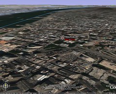
In the menu on the top left, select "Fly To" and write "New York, NY"
Wait a little while and data is streamed, when the progress meter at the bottom shows 100%, all the satellite imagery has been loaded
In the toolbar at the bottom, click on the button that says "Tilt down"

The view should tilt and you can see the city of New York in perspective - only the earth is flat
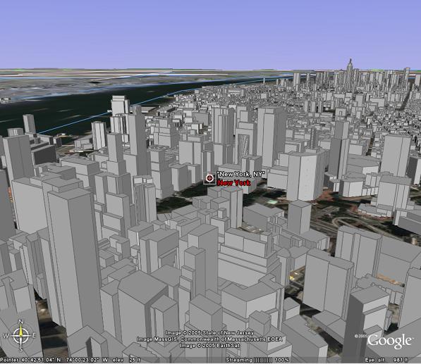
In the "Layers" menu on the left, scroll down and select "3D buildings"
Wait a little and the earth will be populated with the skyscrapers of NY!! They are not texture mapped yet, maybe Google will fix this in the near future....
(Click to see large view)
You can navigate now using the toolbar at the bottom, try flying above the NY landscape...
No comments:
Post a Comment